
An AMC graduate intern is studying whether and how climate change is transforming the tree line on iconic Northeast peaks like Maine’s Katahdin.
There’s a moment you have on every hike where you think, “Why am I doing this to myself?”
It’s a moment where you’d much rather be sitting in a cabin near the fireplace and reading a good book than huffing and puffing up the rest of the mountain. These are what I euphemistically call character-building moments. I recently experienced this while climbing over the Knife Edge on Katahdin, in Maine. With the wind and rain battering my face and visibility down to the wet and slippery rocks just in front of me, I pondered the reasons why I was there.
I am a forest ecologist. I devote my time and energy to understanding how the forests that dominate our landscapes work. To me, being among the trees far away from the nearest human now feels more like home than anywhere else. The research that underlies my profession can inform improved management and conservation of forests for the benefit of both ecosystems and the people that depend on them. However, a major secondary appeal of forests for me are the puzzles they pose that pique my curiosity.
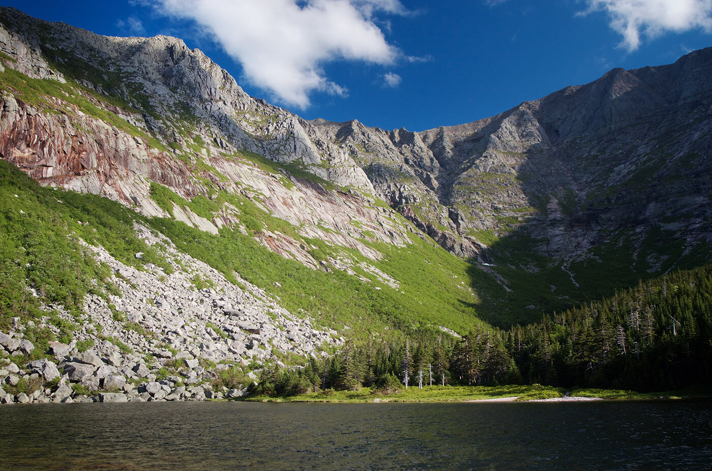
One question in particular has occupied my mind and work this year: Why do trees grow where they do? This is a key ecological question for any group of organisms. Any hiker in the Northeast can picture a familiar pattern. In lower elevations at the start of the hike, you notice trees with large and broad leaves—maples and beech primarily. As you continue the hike and climb further upward, you notice an abrupt change in the trees around you. Broad-leaved trees give way to evergreen, needle-bearing ones, like spruces and firs. Eventually, if you find yourself in the alpine zone of the Presidential Range, the trees are replaced altogether by a seemingly desolate stretch of ground covered with low-lying flowers, mosses, lichens, and rocks. This pattern holds true for most mountains in our region, but why? It certainly is no accident. Like many aspects of the natural world, patterns of tree growth may be influenced by multiple interacting factors.


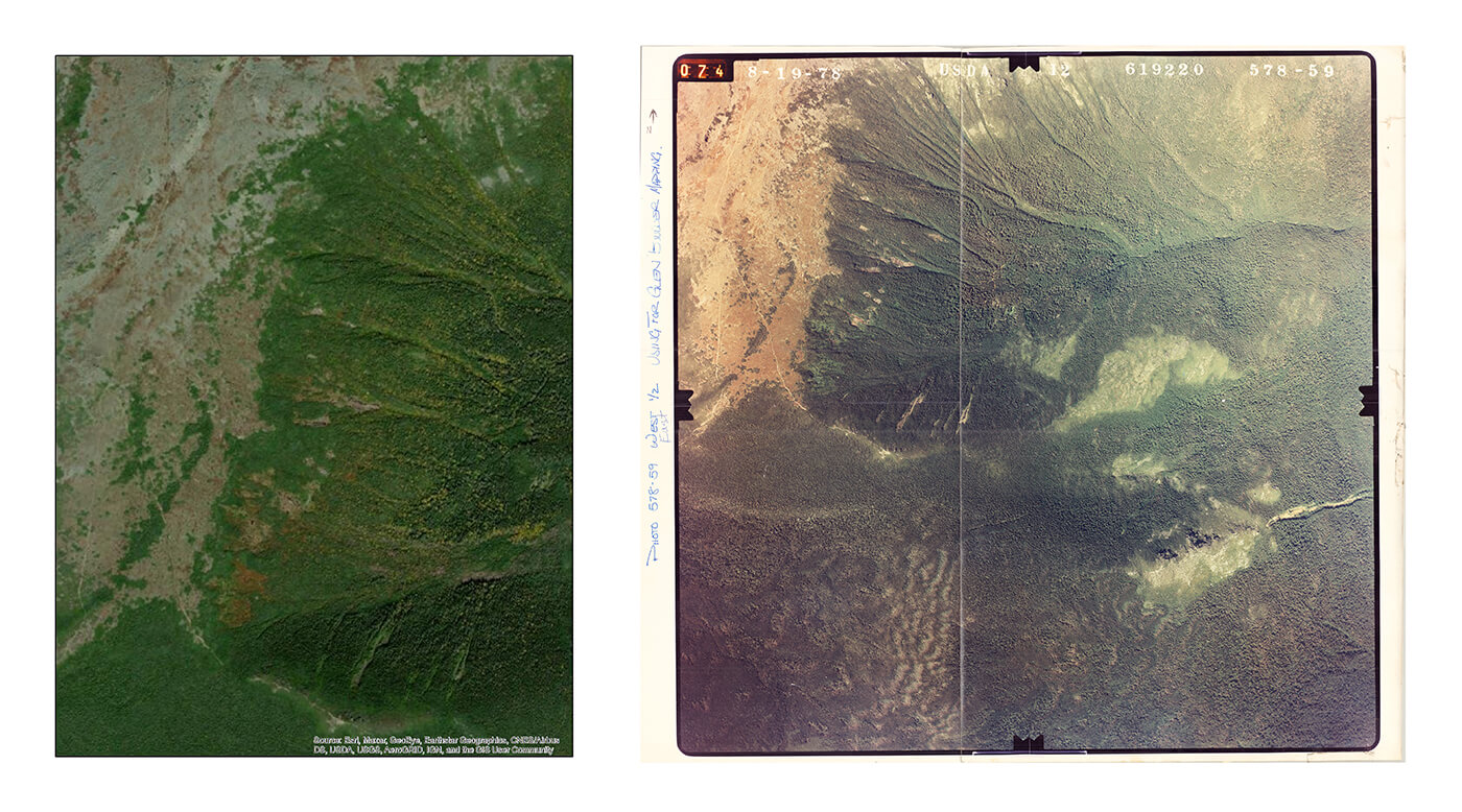
AMC researchers are comparing aerial images of the mountains taken in 1978 (right) and 2018 (left) and analyzing any differences in the the tree lines. “The analysis is still preliminary, but from these images we can see an increase in the area of tree cover to the west (left side of frame) of the edge of the ravine,” according to AMC graduate intern Jordon Tourville.
Many factors dictate where we find different tree species on a mountain. Climate, a complex interaction between temperature, precipitation, the length of the growing season, and many other variables, is one important factor to consider. Tree species have different tolerances to climate, as dictated by their physiology. Maples and beeches are more sensitive to the harsh conditions found at higher altitudes compared to their conifer counterparts, the spruces and firs, which we tend to not find growing higher up. Traditionally, the elevation at which trees can no longer grow upright over 3 meters tall due to these harsh conditions is called tree line, and it has become clear that accelerating climate change has the potential to greatly disrupt its location.
One reason climate change is such a difficult problem to address is because it can be hard to visualize. We can point to recent extreme weather events such as droughts, hurricanes, and floods which are happening more frequently and say, “this is the hand of climate change,” but its influence tends to be more indirect. Climate change denialism is often fueled by the apparent lack of this kind of smoking gun.
Because their locations are often tightly constrained by factors controlled by climate, mountain tree lines offer us a way to directly visualize climate change. Think of tree lines as the barometer for a changing climate: The more severe and prolonged the changes to the climate, the greater the shift we can expect to see in tree line locations. As the climate warms, tree lines are expected to noticeably advance upslope at the expense of the unique and diverse alpine ecosystem of mountain summits, with the rate of advance potentially indicating ecosystem sensitivity to a changing climate. Make no mistake, the relationship between tree lines and climate can be hard to predict at times given that wind, winter icing, and snow cover also play a big role in shaping the tree line landscape. Like most things, the relationship between climate and trees is complex and subtly nuanced.
Thankfully, despite the nuance, we have a way to measure changes in tree line locations. As an ecologist in partnership with AMC, I am using current and historical aerial imagery from the Presidential Range and Katahdin to quantify the advance of tree lines over the past 40 years. These high-resolution images were taken by passing airplanes in the Presidentials in 1978 (1991 for Katahdin) and more recently in 2018. Once these photos are processed, they can be laid over one another using computer software. From there, the process of measuring how far tree lines have moved over the intervening time is relatively straightforward. AMC has conducted similar research in the past, with efforts to map alpine vegetation communities in the late 1990s; however, given the accelerating pace of climate change, a more contemporary investigation is required.
To go one step further, I coupled this approach with ground surveys of forest vegetation at tree lines across the Presidential Range and Katahdin, hence, my harrowing Knife Edge experience on Katahdin. The goal here was to reveal the dominant species at these tree lines and important factors controlling the rate of change. Soil depth, slope, and tree density are all things I’ve measured recently on my excursions. Equipped with these data, I can hypothesize on the impact of climate change on these sensitive alpine ecosystems.


AMC graduate research intern Jordon Tourville spent the summer exploring and collecting measurements in the alpine zones of Mount Washington and Katahdin in an effort to see how climate change affects the location of the tree line.
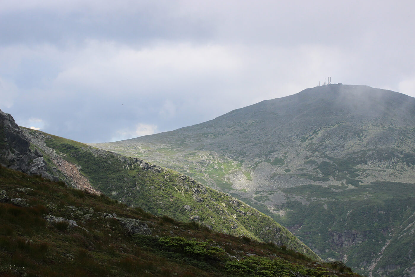
I spent the better part of a month this summer exploring and collecting measurements in the alpine zones of Mount Washington and Katahdin, immersing myself in everything this unique world offers—alpine wildflowers, stunning vistas, and, of course, ripping winds and rain. Within this world, I also noticed the trees at tree line. Their stunted forms became commonplace to me. Sometimes the trees just end in one abrupt line. Other times, pockets of small trees stand isolated from their peers. I wondered to myself what this place will look like in another 40 years. If the trend of warming continues, I would expect to find the extent of alpine vegetation reduced. Based on other research in the Northeast and these climate trends, I fully expect that the tree line has advanced since the 1970s, but my analysis is still in the works. As I completed my fieldwork and left the alpine for what promises to be a long winter of analyzing the aerial images, I promised myself that I would return one day to see if my prediction had come true.
High-elevation forests and mountain alpine zones are an integral part of the cultural heritage and physical landscape of the northeastern United States. These areas harbor rare species, provide important ecological services, and are known nationally for their contribution to conservation and recreation. My hope is that this tree line mapping project will contribute valuable knowledge to AMC’s longstanding mountain research program and serve as a baseline to promote better management of our mountain communities. Results from this work will be foundational for researchers and land managers in prescribing potential climate adaptation strategies. Most importantly, the people who enjoy these irreplaceable areas will benefit from the improved conservation and understanding of our mountain peaks in a warming world.