


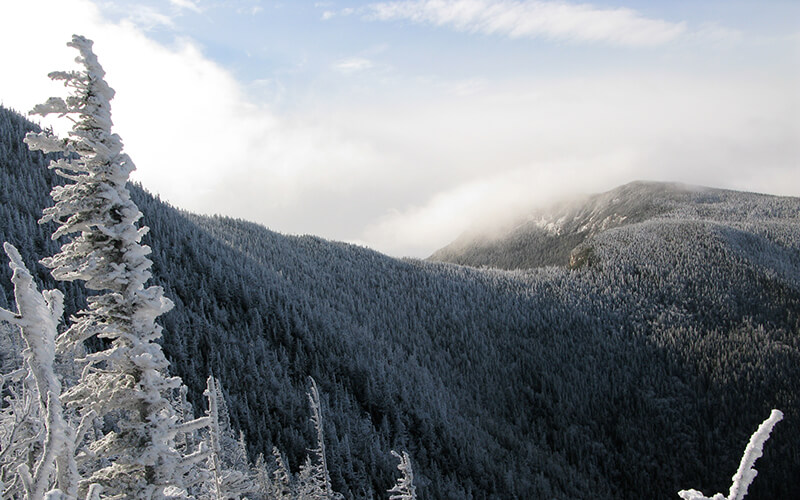
Long before chairlifts and crowded resorts defined winter recreation, skiers were climbing mountains under their own power, carving turns down forested slopes, logging roads, and alpine ravines across New England and New York. From Scandinavian loggers in the mid-1800s to the trailblazing skiers of the 1930s, the Northeast was once a thriving hub of “down-mountain” skiing. The Civilian Conservation Corps etched enduring ski trails into mountains like Mount Mansfield, Cannon, Cardigan, and Greylock—routes that still define classic backcountry skiing today. While lift-served skiing eventually pulled crowds away, dedicated skiers kept these traditions alive, preserving a quieter, more self-reliant way to experience winter.Today’s resurgence in backcountry skiing returns to those roots. Skiers are skipping crowded, expensive resorts in favor of more peaceful and affordable options. We won’t lie: not relying on a lift to get up the mountain is tough. Backcountry skiers have to hike or skin up the mountain to earn their turns. But the thrill of the journey and the quiet of the snowy woods are worth it.
We’ve rounded up some of the top backcountry skiing destinations in the Northeast, sourced from the second edition of AMC Books’ Best Backcountry Skiing in the Northeast. (AMC’s Winter Recreation Map and Guide is an even more portable resource.)
Please note: This list is not for beginners. We encourage you to go with a guide for your first backcountry run. If you want to learn new skills or ski in a group, AMC hosts a number of community ski events every winter.
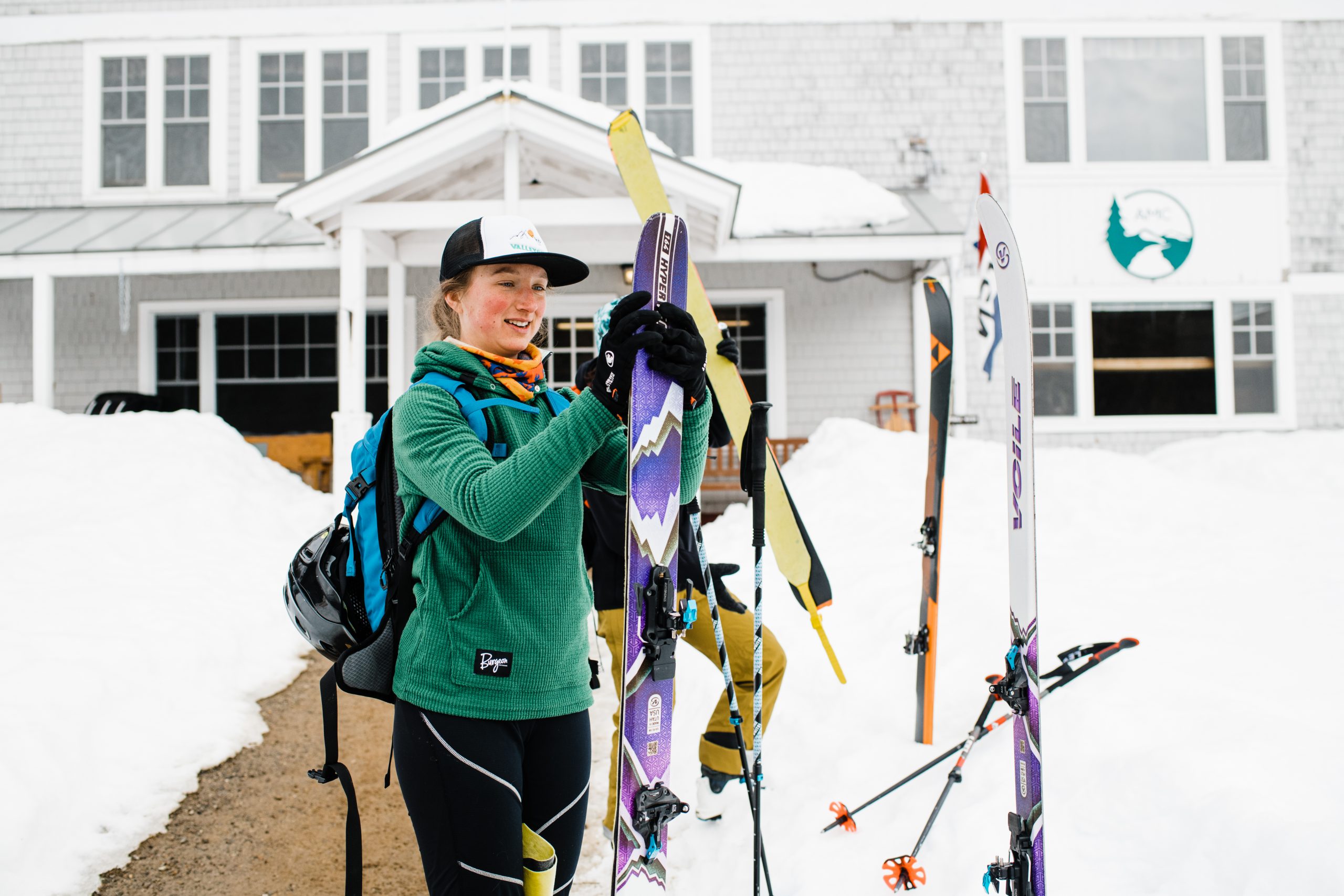
Preparing for a backcountry ski expedition outside of Cardigan Lodge, NH. Photo by Alexandra Roberts.
Backcountry Skiing 101: Conditions, Safety Tips, and Resources
Mountain conditions in the winter are dynamic and highly variable, and backcountry terrain can be challenging for newer skiers. Here are some resources to help you prepare for a safe and enjoyable backcountry ski trip:
- For up-to-date weather forecasts at AMC locations, visit our Weather & Trail conditions page.
- If you’re skiing Tuckerman’s Ravine, make sure to check the Mount Washington Observatory Higher Summits Forecast, and confirm Sherburne Trail is skiable.
- Make sure that you dress properly and pack the 10 Essentials. If you’re backcountry skiing in New Hampshire, White Mountain Ski Co. offers gear rentals.
- New to backcountry skiing? Here’s how to get started.
7 of the Best Backcountry Ski Routes in the Northeast
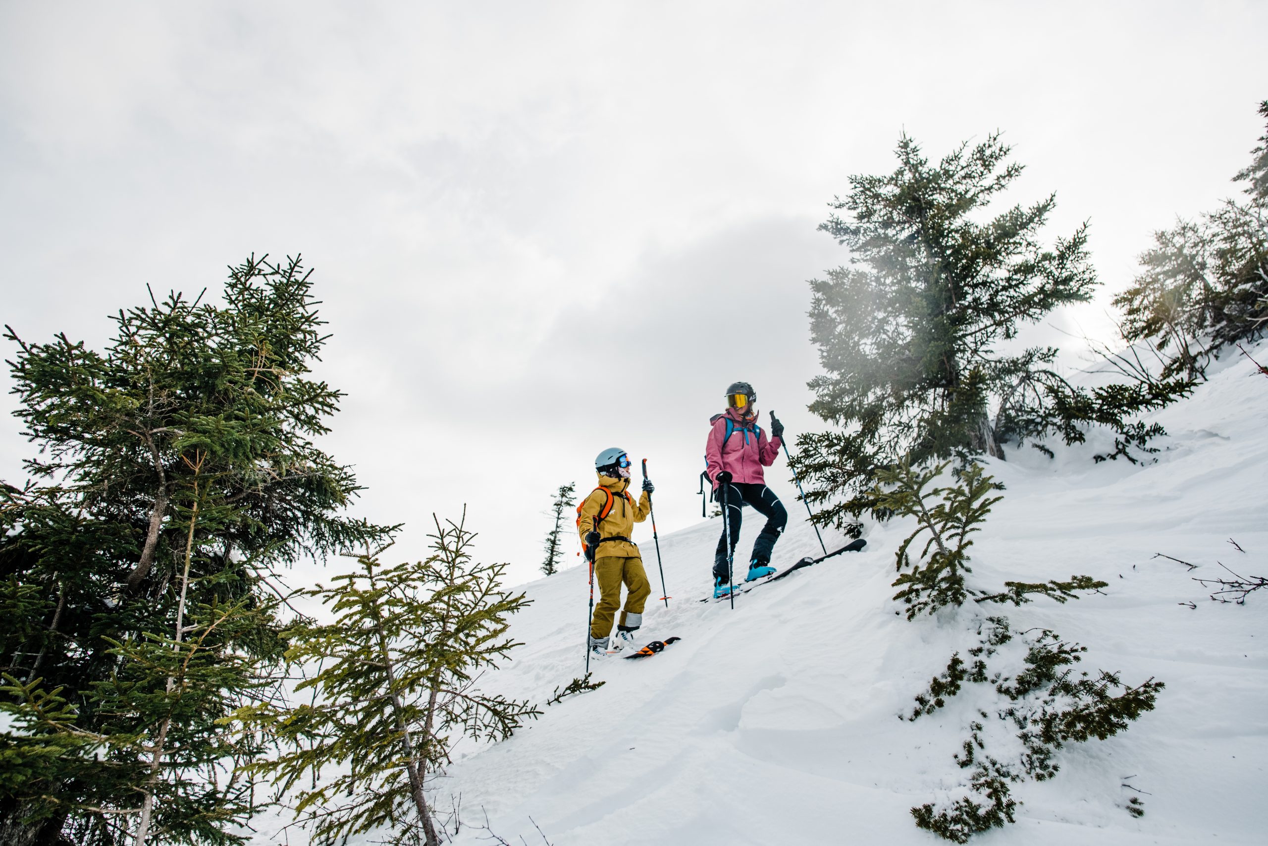
Mt. Cardigan, New Hampshire. Photo by Alexandra Roberts.
1. Mt. Cardigan, White Mountain National Forest | Orange, N.H.
Distance: 3.2 miles, AMC Cardigan Lodge to top of Duke’s Ski Trail, round trip; 5 miles, AMC Cardigan Lodge to Mount Cardigan summit, ascending via Holt-Clark and Clark trails, descending on the Alexandria and Kimball ski trails, round trip
Difficulty: Alexandria Trail—Most Difficult; Duke’s Trail and Kimball Trail—Difficult/Moderate
The ski trails on Mount Cardigan and neighboring Firescrew are among the most historic runs in New England. Mount Cardigan—“Old Baldy” to the locals—was the center of activity for the Appalachian Mountain Club’s skiers after the club purchased 600 acres and a barn on the east side of the mountain in 1934. The club’s interest was inspired by the fact that Cardigan, at 3,149 feet, is the second-highest peak in southern New Hampshire (3,165-foot Mount Monadnock is the highest in the region) and only 2 hours from Boston. Today, Mount Cardigan is the crown jewel of a 1,200-acre reservation owned by AMC.
The Duke’s Ski Trail is a classic down-mountain route with a moderate, even pitch and long traverses that make for enjoyable, confidence-building turns. About 15 feet wide and framed by mature hardwoods, the trail finishes on open snowfields just below Firescrew’s bald cone, where you can catch expansive views. Its consistent grade and gentle S-turns near the top make it a popular ascent and descent option.
The Alexandria Ski Trail is Mount Cardigan’s most challenging and celebrated run, dropping roughly 800 vertical feet in 0.75 miles. Designed in the CCC era, the trail bends and turns continuously, often presenting a sporting double fall line that rewards strong, technical skiers. With sustained pitches of 20–25 degrees and ample width for linking turns, it remains one of the finest down-mountain ski trails in the East.
The Kimball Ski Trail is a quiet, often overlooked descent through lower-elevation forest. Roughly a mile long and about 15 feet wide, it drops gently through softwoods beneath a dense canopy that gives the trail a deep-woods feel. Frequently skied at the end of a Cardigan tour, it provides a graceful and satisfying return to Cardigan Lodge.
You can stay at the Appalachian Mountain Club’s historic Cardigan Lodge for easy mountain access. The lodge is self-service in the winter season—no meals are provided, but you can bring your own food and cook in the kitchen. During the winter you can also book by the bunk, which makes the nightly rate even cheaper.
Acadia National Park in Maine—including Sargent Mountain—offers some of the region’s most epic backcountry skiing.
2. Sargent Mountain, Acadia National Park | Mount Desert, Maine
Distance: 5.6 miles from Parkman Mountain parking lot to the Sargent Mountain Summit
Difficulty: Moderate
This moderate backcountry route tours Sargent Mountain, opposite to the more highly-trafficked Cadillac Mountain with stunning and unique views of the Atlantic Ocean. From the Parkman Mountain parking lot (accessed from ME 198, just west of Eagle Lake and a half mile from Upper Hadlock Pond), turn right, and in 100 feet you will reach an intersection with a carriage road. If you’re interested in a direct, 2.8-mile hike to the summit of Sargent Mountain (1,373 feet), turn right onto the Around Mountain Carriage Road, then turn left at Junctions 13 and 12. If you prefer a longer route, take a left and use the Around Mountain Lower Loop. On this route, you’ll ski for 3.2 miles, when you reach Junction 11, turn right, and ascend 200 feet. Take a sharp right at Junction 10 toward the Around Mountain Lower Loop, to ski up the face of Sargent Mountain. You’ll see the Sargent Northwest Trail on the left after 1.7 miles, and from here, the summit is just a 0.7-mile gentle climb along the north face of Sargent Mountain. Ski south along the Maple Spring Trail until you hit Maple Spring, then ski a snowfield on your left. Stay left of Maple Spring Trail on the ridge above a stream after crossing Grandgent Trail, then ski through the trees down to the Hemlock Bridge until you come to the Upper Hadlock Carriage Road Loop. Turn right and return to intersection 12, turn left again, and then right at intersection 13. The Parkman Mountain parking lot will be on your left.
AMC Zealand Falls Hut in the White Mountains, New Hampshire. Photo by Emily Davenport.
3. Zealand Falls Hut, White Mountain National Forest | Jefferson, N.H.
Distance: 13.8 miles round trip via Spruce Goose Ski Trail; 12 miles round trip via Zealand Road and Zealand Trail
Difficulty: Moderate
Zealand Falls Hut is one of three AMC huts, along with Lonesome Lake and Carter Notch, that remain open in winter, and of the group, it’s surrounded by the best variety of skiing. Whether you’re heading in and out on a day trip or you’ve reserved a bunk for the night, stop in for a hot cup of cocoa before you strap your skis back on again. The hut offers a starting point for this tour through the breathtaking Pemigewasset Wilderness, which features ice cliffs, waterfalls, and mountain ponds.
Zealand Road isn’t plowed in winter, so from the parking area on Route 302, skiers can choose Spruce Goose Ski Trail or the parallel Zealand Road. Both routes provide a gradual grade and a nearly straight shot toward the hut, eventually merging into Zealand Trail for the final stretch.
Whichever trail you choose, this tour climbs gently but steadily, rising about 1,000 feet over the first 6.7 miles. Only the last quarter mile provides a big challenge; for this you’ll want to step out of your skis and walk up the steep rise to Zealand Falls. Perched 200 feet above the Ethan Pond Trail–Twinway junction, on the edge of the 45,000-acre Pemigewasset Wilderness, the hut provides access to an array of additional adventures, many of which you can find in Best Backcountry Skiing in the Northeast by David Goodman (AMC Books).
Winter turns East Osceola Mountain (background) into a magical wonderland, ideal for backcountry skiing.
4. Greeley Ponds | Lincoln, N.H.
Distance: 4.4 miles to Lower Greely Pond, round trip
Difficulty: Moderate
This easygoing trip takes you around the stunning Greeley Ponds, between high rock features and ice cliffs. Parking can be found at the Greeley Ponds trailhead, 4.7 miles east of Lincoln Woods Visitor center on the Kancamagus Highway, and is limited to 10 cars on the south side of the road.
Start by following the Greeley Ponds Trail through the trees at a mild incline—it will intersect with the bottom of the ski trail after 1.3 miles at Mad River Notch. Stay on the trail for another 0.3 mile before arriving at Upper Greely Pond, where you can enjoy the open view of the frozen pond through the forest, while high rock outcroppings and ice cliffs drip down from East Osceola. From there, you can choose to ski across the frozen pond if they are sufficiently frozen, or simply trace the hiking route which guides you along the western perimeter at the southern point of the pond. The ski trail marked with blue plastic blazes guides you downhill, and then intersects again with the yellow-blazed hiking trail and drops you off at Lower Greeley Pond. With parking on either end of the route, simply turn back the way you came to return to your car.
If you want to stay in the area, AMC’s Highland Center is less than an hour away. Joe Dodge Lodge and Cardigan Lodge are also nearby.
Information: U.S. Forest Service
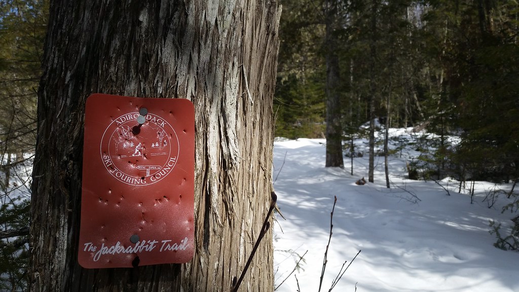
Photo by adkmusic, courtesy of Flickr Commons.
5. Jackrabbit Ski Trail | Lake Placid, N.Y.
Distance: 5.5 miles one way from Whiteface Inn to McKenzie Pond Road
Difficulty: Moderate
This route, which takes you on a tour between Lake Placid to Saranac Lake, provides a diverse combination of flat, uphill, and downhill terrain. Start from one of two trailheads, the McKenzie Pond Road Trailhead or Lake Place Trailhead to access the Jackrabbit Ski Trail, a segment of a 35-mile hiking and skiing trail system connecting Tupper Lake to Keene. To access the Lake Placid Trailhead from NY 86 (heading west), take a right on Whiteface Inn Lane and drive for 1.3 miles. Opposite the entrance to the Whiteface Club, you will see the red plastic Jackrabbit Trail marker; park outside of the trailheads on either end. From the trailhead on Whiteface Inn Road, ski your way up the gentle incline of the old logging road. In the 1930s, the Civilian Conservation Corps (CCC) transformed this logging road into a fire trail to make it more accessible to firefighters if the need arose. The route continues uphill, meandering over the slope of McKenzie Mountain (3,862 feet). Expect the trail to level out as you reach the birch and spruce-lined plateau. A lean-to marks the trail junction 2.1 miles from Haystack Mountain’s summit. Soon after, you’ll arrive at a trail junction. A sign indicates that you are 2.1 miles from the summit of Haystack Mountain. Either follow this sign toward the Haystack summit (4,961 feet) or stay on the Jackrabbit Trail as it heads back downhill, this is a good spot to reverse if you want to return back to your car.
Information: Barkeater Trails Alliance
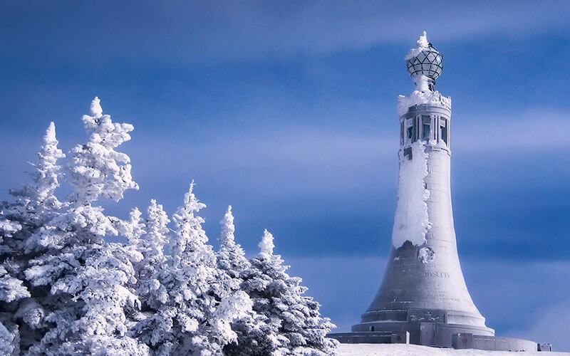
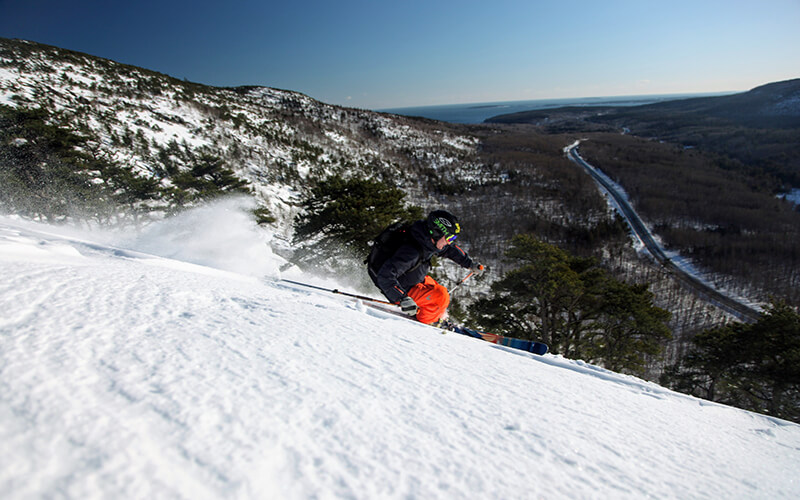
Mount Greylock in Massachusetts serves as a gorgeous backdrop for backcountry skiers enjoying its Thunderbolt Ski Trail.
6. Thunderbolt Ski Trail, Mount Greylock | North Adams, Mass.
Distance: 6 miles round trip
Difficulty: Difficult
This former ski racing trail has been restored to its former glory as an acclaimed down-mountain route for backcountry skiers. Drive west up Maple Street from MA 8 in Adams and take a right on Gould Road. Continue straight onto Thiel Road, which terminates with a set of concrete barriers—park here. Past the barriers, a sign for Thunderbolt Ski Trail starts your journey onto the 8-foot-wide foot path. Follow the route over the Hoxie Brook, and at the fork, go right onto the Thunderbolt Trail. Follow this up a steep incline to a 4-way intersection and kiosk. Ascend the Thunderbolt Trail by turning right and onto the Bellows Pipe Trail; bear left at 0.3 mile and head up the mountain. When you connect with the Appalachian Trail, turn left and continue for approximately five minutes until you see the Thunderbolt Ski Trail, from there it’s 0.4 mile to the summit of Mount Greylock (3,491 feet). Before dropping into the Thunderbolt downhill from the summit, stop in at the Thunderbolt Ski Shelter for a rest and a snack. The Thunderbolt is visually striking and requires expert navigation with a 35-degree slope that turns right, even as the slope pitches downward to the left. As the trail narrows, you’ll accelerate as you barrel toward a stretch called the Needle’s Eye. This final segment of the trail is just 15 feet wide and turns swiftly to right. There is a final steep pitch before the finish.
Info: Thunderbolt Ski Runners
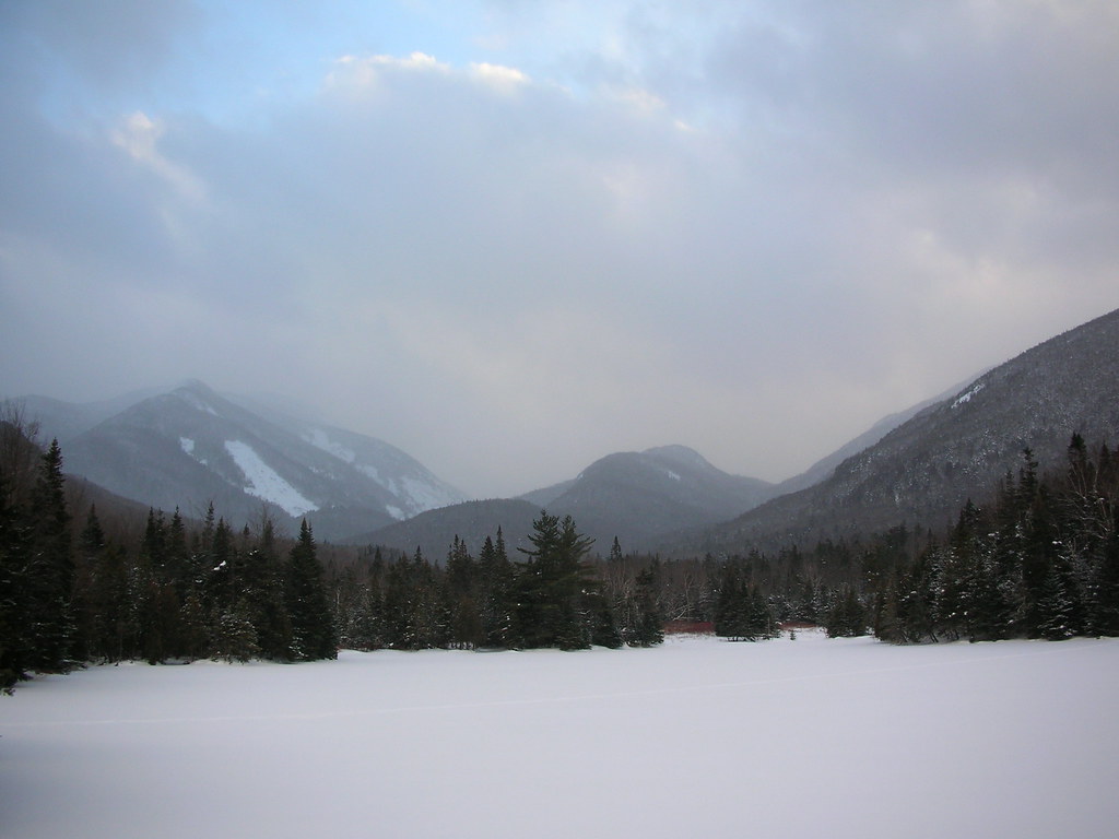
View from Marcy Dam. Photo by Stantont, courtesy of Flickr Commons.
7. Avalanche Pass and Lake Colden, Newcomb, N.Y.
Distance: 10.6 miles round trip
Difficulty: Difficult
The trek over Avalanche Pass to Lake Colden might lack the high-elevation views of nearby Mount Marcy (New York’s highest peak at 5,344 feet), but it makes up for that with its natural beauty. One of the finest ski tours in the Adirondacks’, this trip departs from the ADK High Peaks Information Center, where you can inquire about trail conditions, and follows the Van Hoevenberg Trail. At the trail junction at Marcy Dam, about halfway out to Lake Colden, pause to take in the view. Wright Peak (4,587 feet) looms overhead, as does Avalanche Pass, 2.2 miles ahead on the trail.
Dramatic scars on Wright Peak, the result of recent landslides and avalanches, highlight the sometimes dangerous reality of this rugged backcountry setting. The trail climbs over Avalanche Pass at 3,000 feet, in between Algonquin Peak (5,115 feet) and Mount Colden (4,715 feet). Then it empties onto frozen Avalanche Lake, where you’ll be surrounded by dramatic cliff faces, draped with ice and wind-swept snow. Goodman describes the setting as “a magnificent natural art gallery that cannot help but leave you in awe.” The beauty continues just ahead, where the trail reemerges at your destination: Lake Colden, with Mount Colden and Algonquin Peak dominating the scenery.
Your biggest technical challenge awaits on the long return descent from Avalanche Pass. “Consider [it] your bachelor’s degree in Eastern trail skiing,” Goodman writes of the big, curving downhills interspersed with flat stretches where you can relax. All in all, Goodman says, Avalanche Pass and Lake Colden make for “one of the most spectacular ski tours in the eastern United States.”